
D.C. officials will study travel patterns in Foggy Bottom this spring to consider better connecting Foggy Bottom to the Georgetown Waterfront and Rock Creek Park through improved traffic infrastructure.
Ron Barron, a community planner for the D.C. Office of Planning, said the study will work to decide whether city planners can create new pedestrian and cyclist access between Foggy Bottom, the Georgetown Waterfront and Rock Creek Park to get around the Potomac River freeway network, which slices through the neighborhoods. Barron said officials will study how nondrivers travel through the Foggy Bottom Historic District and the Georgetown Waterfront area to recommend changes in neighborhood freeway and transportation layouts by fall 2023.
Barron said the data will compile pedestrians’ transit experiences along Foggy Bottom corridors with heavy vehicle, bicycle and pedestrian traffic – like G Street and Virginia, Pennsylvania and New Hampshire avenues – through man-on-the-street polling this spring.
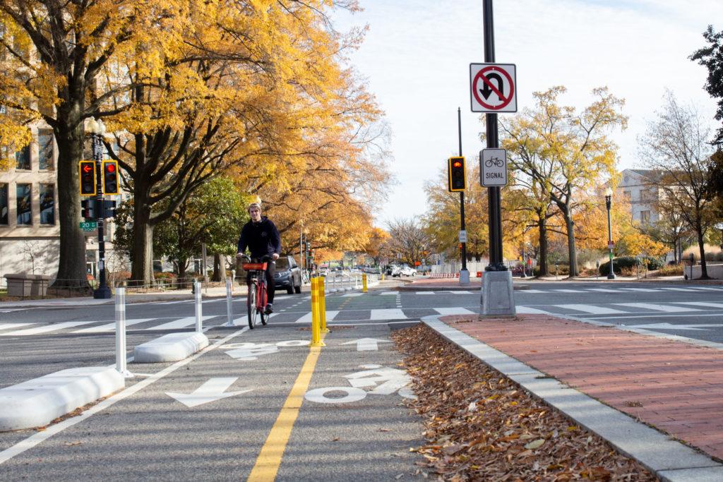
But members of the Foggy Bottom and West End Advisory Neighborhood Commission said the study’s focus on pedestrian movement overlooks vehicular traffic patterns in the area. They said they were “confused” about the timing of the study, coming after District Department of Transportation officials installed protected bike lanes on Virginia Avenue last year to connect Rock Creek Park to the National Mall.
Barron said Foggy Bottom is a “good candidate” for nonvehicular observation because DDOT officials installed three sets of protected bike lanes in Foggy Bottom within the last two years. DDOT implemented a bike lane along G Street in Foggy Bottom in 2020, added another lane running through 20th and 21st streets in 2021 and installed the most recent set along Virginia Avenue from Rock Creek Trail to Constitution Avenue last year.
“There’s been a lot of work there, so we think this is a good opportunity for us to collect some very good data on how, with all the improvements, are people experiencing the connections that exist,” Baron said.
Barron said the connection between the Foggy Bottom Historic District, which includes most of the northeast corner of the neighborhood, has been a “massive” area of constituent concern for years. Local leaders said the Potomac River Freeway – an east-west leg of Interstate 66 crossing between D.C. and Virginia – forms a dividing line of traffic between the District and Georgetown and stifles uninterrupted, nonvehicle access between the areas.
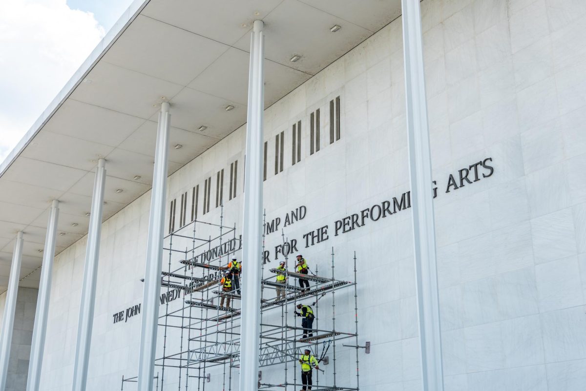
The Office of Planning’s Comprehensive Plan, a guide for long-term urban planning in D.C., recommended a neighborhood study last year to investigate the “feasibility” of reconfiguring highways in Foggy Bottom and improving nonvehicular connections to Georgetown.
The freeway cuts underneath Virginia Avenue and includes an interchange with the Rock Creek and Potomac Parkway and two ramps leading to either Georgetown via the Whitehurst Freeway or L Street. Barron said Foggy Bottom pedestrians and cyclists had “more access” to Rock Creek Park before the freeway’s installation in 1961, which displaced more than 270 families during the road demolition process.
He said the Office of Planning’s study will weigh various options to revive this pedestrian connection, like adding a “linear park” – a skinny stretch of green space – to the Whitehurst Freeway, removing I-66 entirely, installing a pedestrian bridge or “capping it over” with a deck bridge built on top of the roadway, which are commonly used to house new parks or buildings in urban areas.
“We’re specifically looking at the connections between the residential areas and the amenities,” Barron said.
He said there has been a gap in collected data on nonvehicular Foggy Bottom traffic since DDOT officials surveyed pedestrians and formed a master plan in 2009, where constituents recommended expanding bike lanes, pedestrian safety programs and upkeep of crosswalks in Foggy Bottom.
Barron said the Office of Planning consulted with DDOT to find out what the department has already studied in the area after the department installed the Virginia Avenue bike lane last year. DDOT conducts Traffic Safety Investigations using constituent-submitted service requests and collects traffic safety data about crashes, fatalities and injuries as part of Mayor Muriel Bowser’s Vision Zero program to eliminate traffic deaths.
Barron said if constituents feel that restricting the study to nonvehicular statistics is a “tremendous mistake,” DDOT will incorporate vehicle traffic data along certain corridors as deliberations over the survey’s scope continue.
“We are continuing to work with them as this project progresses,” Barron said.
Barron said he doesn’t know why DDOT installed the Virginia Avenue bike lane without the Office of Planning’s study beforehand. He said DDOT and Vision Zero studies have usually been vehicle and safety-focused instead of emphasizing residents’ transit experiences.
“That isn’t to say that DDOT is not doing outreach, that they’re putting in bike lanes without doing any kinds of studies,” Barron said. “I don’t know if they’re specifically doing this type of study, but there’s a process for planning that every department has to follow, and that includes collecting data, doing public outreach.”
DDOT did not return multiple requests for comment.
ANC commissioners suggested the Office of Planning include data about vehicle traffic in the study to ensure the study reflects all modes of transportation throughout Foggy Bottom. Others said the department should have conducted the study before installing a protected bike lane on Virginia Avenue last year, which presents safety issues for pedestrians with mobility impairments.
Commissioner Donna Barbisch – who represents the Southeast side of Foggy Bottom, which includes Virginia Avenue – welcomes the Office of Planning’s study but said officials should also interpret vehicle data because cars are a major component of transit along Foggy Bottom corridors.
“Roads are part of our infrastructure,” Barbisch said. “If you don’t start with them, then you’ve got to work around them.”
During November’s ANC meeting, constituents and commissioners questioned why DDOT officials installed protected bike lanes along Virginia Avenue last year without a previous Office of Planning survey investigating pedestrian needs on the road. Some said the city’s removal of a pedestrian refuge island on the Virginia and New Hampshire avenue intersection created crosswalk safety concerns for pedestrians with mobility restrictions like some senior citizens who may not be able to cross the street in the time the crossing signal allots.
“I’m a little confused by this,” Dina Fox, a constituent at last month’s ANC meeting said. “How is it possible to start such a study after you’ve already put in the bike lane? Isn’t that the sort of thing that should have preceded the bike lane?”
Joel Causey, the chair of the ANC, said the DDOT “fumbled” the Virginia Avenue bike lane process by skipping a constituent vetting period and sacrificing the street’s “safe haven” stopgap as a result. He said the pedestrian safety issues stemming from the island’s removal could’ve been avoided if D.C. had conducted an Office of Planning study before the lanes’ installation.
“The end result is, I don’t think we have a bike lane system that serves the people correctly and is entirely safe for everybody,” Causey said.